Navigating the Black Hills
A map of the Black Hills can come in handy, especially when trying to navigate on your own. Getting around the Black Hills can be a little challenging, which is why we offer you a detailed map of the Southern Black Hills, with all its points of interest, campsites, restrooms, and road names. This is the map I use when plotting out a private tour of the Black Hills of South Dakota. There’s so much to see that you’ve got to have a plan for visiting the Black Hills properly, or you could hire me and I’ll take the work out of it!

How to Read a Map of the Black Hills
A First-Timer’s Guide to Exploring South Dakota’s Most Fascinating Region
When travelers look at a map of the Black Hills for the first time, there is usually a moment of confusion. The roads twist through granite peaks. Scenic byways circle one another. A single highway can change names three times. If you have never explored this area, the layout can feel like a puzzle. The good news is that once you understand how the Black Hills connect, the entire region becomes a joy to navigate.
My XO Adventures guides travelers through these roads every day, and we know this landscape as well as anyone. Whether you are planning a self-guided trip or considering one of our tours, this guide will help you use a map of the Black Hills to plan a smooth, relaxed, and rewarding visit.
Getting Oriented: What You See on a Map of the Black Hills
A map of the Black Hills shows a region full of protected land, scenic drives, historic sites, and natural wonders. Custer State Park sits toward the southeastern portion of the hills, Mount Rushmore rises on the eastern side, and the Black Hills National Forest stretches across the heart of the area. What makes this region special is how close everything is. You can drive from rolling prairie to granite spires, then to lakes and forests, all in the same morning.
For a new visitor, the main challenge is simply knowing which direction to go first. On the map, you will notice:
-
The tangle of scenic roads near Custer State Park
-
The narrow corridors leading to Mount Rushmore
-
The looping curves of Needles Highway and Iron Mountain Road
-
Entry points from Rapid City and Hill City
-
Iconic stops like the Wildlife Loop, Sylvan Lake, and the Needles Eye Tunnel
Understanding these areas ahead of time prevents unnecessary backtracking and helps you make the most of your time.
Why the Northern and Eastern Roads Look So Complicated
People often pause when they study the northern and eastern side of a map of the Black Hills. The roads in this region were designed to highlight scenery rather than provide fast, direct travel. Curves, tunnels, and switchbacks are all intentional. Early planners wanted travelers to slow down, relax, and enjoy the views.
This is why many first-timers feel overwhelmed. The layout is beautiful, but it is not straightforward. Once you know what each road offers, the map makes a lot more sense.
Starting Point: Entering After Mount Rushmore
Most visitors begin at the top of the map of the Black Hills, entering the region after their stop at Mount Rushmore National Memorial. This is one of the most common routes because Mount Rushmore is a natural anchor for the day.
From this area, drivers often choose Iron Mountain Road, known for its pigtail bridges, stunning overlooks, and tunnels aligned to frame Mount Rushmore in the distance. It is not a fast road, but it is memorable. The scenery alone makes it worth the trip.
Iron Mountain Road eventually connects with Highway 36, which leads you west to Highway 16A. This is where your map becomes especially helpful, because 16A is more than a road. It is a gateway into one of the most remarkable parks in the country.
A Key Stop on the Map: Custer State Park Visitor Center
When you follow 16A on the map of the Black Hills, you will notice a marker for the Custer State Park Visitor Center. This is one of the best planning stops you can make. The center provides:
Real-time wildlife updates
Trail recommendations
Safety information
History and ecology exhibits
Rangers who can answer any question
Stopping here saves time, reduces confusion, and helps you plan your route with confidence. With a better sense of conditions and wildlife movement, navigating the map becomes easier.
The Wildlife Loop: What Your Map Is Trying to Tell You
If you look toward the lower portion of your map of the Black Hills, you’ll see a curved road forming a long “U.” This is the Wildlife Loop Road, one of the most cherished parts of Custer State Park. It is also the point on the map that often confuses travelers because of its shape.
The Wildlife Loop is best explored slowly. Here you may encounter bison herds, pronghorn antelope, prairie dogs, deer, and the famous resident burros. The land is open, rolling, and peaceful. If you are traveling with kids, this area is especially exciting.
At the halfway point of the loop, the road begins to shift back toward 16A. Your map will show this clearly, and once you see where it reconnects, you are ready for the next phase of your adventure.
Heading Toward the Needles: Turning North on Needles Highway
Once you finish the Wildlife Loop and return to 16A, your map of the Black Hills will guide you north toward one of the most iconic roads in the entire region: Needles Highway.
To enter Needles Highway, you will turn right on 16A, then left onto SD-87. As the road climbs, the landscape changes rapidly. Forest thickens. Granite towers rise from the hills. Lakes and streams appear around corners. It is one of the few places where every turn presents a new surprise.
Your map may not capture the sense of elevation or the dramatic rock formations, but it does show the winding nature of the road. This helps set expectations. Needles Highway is meant to be slow, calm, and immersive, with time to enjoy viewpoints and pullouts.
Destination on the Map: The Needles Eye Tunnel
Near the top of your map of the Black Hills along Needles Highway, you will find a narrow passage marked with a small roadway symbol. This is the Needles Eye Tunnel, a slender cut through granite that has become one of the most photographed spots in the region.
It is a single-lane tunnel, and traffic alternates. Slow down. Enjoy the moment. Many travelers choose to stop nearby and take photos of the towering granite spire known as the Needles Eye. This is a highlight of the Black Hills and a perfect example of why the roads look the way they do on the map.
The curves, the elevation changes, and the placement of roadside pullouts were designed to help visitors absorb the natural beauty surrounding them.
Using a Map of the Black Hills to Plan Your Day
A map of the Black Hills becomes your best companion when you begin to link attractions into a logical path. Here are simple planning tips that help you visualize your day: As you explore attractions in Black Hills, consider starting with the iconic Mount Rushmore before heading over to Custer State Park. Each stop offers unique experiences that highlight the natural beauty and rich history of the region. Planning your route in advance allows you to maximize your time and fully enjoy everything this stunning area has to offer.
1. Begin at the Top
Start with Mount Rushmore or the Iron Mountain Road area. This gives you a natural entry point from most nearby towns.
2. Move South or Southeast
Use 16A to guide you into Custer State Park. Your map will show several entry points, and most routes lead you toward the visitor center.
3. Loop the Wildlife Area
Follow the U-shaped Wildlife Loop as it directs you through open grassland and wildlife territory.
4. Climb Toward the Spires
End with Needles Highway, allowing your day to build toward dramatic scenery and cool mountain air.
5. Track Time and Distances
The Black Hills look close on a map, but winding roads require more driving time than straight highways. Build in time for stops, photos, and slow-moving wildlife.
Why a Map of the Black Hills Matters
Even with GPS, a map of the Black Hills helps you understand the region in a deeper way. Phones may lose signal in forested or rural areas. A physical or downloaded map provides:
-
A big-picture view of the region
-
Insight into how roads connect
-
Backup navigation
-
Better decision making when plans change
-
Confidence when choosing scenic routes
Having a map on hand turns uncertainty into enjoyment and helps you feel grounded in the landscape.
Need Help Navigating? We Are Here For You
If reading a map of the Black Hills feels like a lot, you are not alone. Many first-time visitors feel the same. That is why My XO Adventures handles routing, navigation, and timing for you. Our guides know the hidden pullouts, the wildlife patterns, the changing conditions, and the stories behind the landscape.
With us, you can relax, enjoy the views, and let someone else handle the details.
Frequently Asked Questions About the Black Hills Map
Where are the Black Hills located on a map?
The Black Hills are located in western South Dakota and extend slightly into northeastern Wyoming. On a U.S. map, they sit east of the Rocky Mountains and west of the Missouri River. The region forms a forested island rising above the surrounding Great Plains, centered around Rapid City, South Dakota.
What cities are located in the Black Hills?
The primary cities and towns in the Black Hills include Rapid City, Deadwood, Spearfish, Sturgis, Hill City, Keystone, Custer, and Hot Springs. Rapid City is the largest city and serves as the main gateway for visitors exploring the region.
How big are the Black Hills on a map?
The Black Hills cover roughly 125 miles north to south and about 65 miles east to west, spanning around 5,000 square miles. The majority of the area lies within South Dakota, with a small portion extending into Wyoming.
Why do the Black Hills look different from the surrounding plains on a map?
The Black Hills stand out on maps because they rise dramatically from the surrounding Great Plains. Dense forests cover the mountains, which appear darker from a distance. Early explorers described the region as looking black from afar, which led to the name “Black Hills.”
What is the highest point shown on a Black Hills map?
The highest point in the Black Hills is Black Elk Peak, which reaches 7,244 feet above sea level. It is the tallest mountain in the United States east of the Rocky Mountains.
What national parks and monuments appear on a Black Hills map?
Several major landmarks appear on maps of the Black Hills, including:
• Mount Rushmore National Memorial
• Wind Cave National Park
• Jewel Cave National Monument
• Devils Tower National Monument (just west in Wyoming)
• Custer State Park
• Black Hills National Forest
These locations form the core of many travel routes through the region.
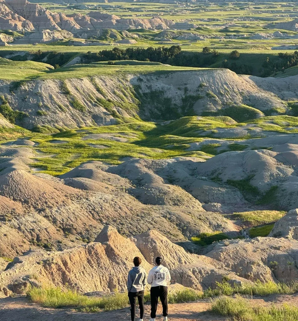
How far is the Black Hills from the Badlands?
The Badlands sit about 50 to 70 miles east of the Black Hills, depending on the route taken. From Rapid City, most visitors can reach Badlands National Park in about one hour by car.
Are the Black Hills easy to navigate with a map?
Yes. The Black Hills have a well-developed network of scenic highways including Highway 16, Highway 385, Needles Highway, Iron Mountain Road, and Spearfish Canyon Scenic Byway. Most visitors can explore the region comfortably using a standard road map or digital navigation.
How long does it take to drive across the Black Hills?
Driving from the northern edge near Spearfish to the southern edge near Hot Springs typically takes two to three hours, depending on the route and scenic stops along the way.